Wednesday, March 31, 2010

Santorini Caldera View, Greece


Caldera View, originally uploaded by Klearchos Kapoutsis.

Santorini (Greek: Σαντορίνη, pronounced [ˌsa(n)do̞ˈrini]) is a small, circular archipelago of volcanic islands located in the southern Aegean Sea, about 200 km (120 mi) southeast from Greece's mainland. The largest island is known as Thēra (or Thira, Greek Θήρα [ˈθira]), forming the southernmost member of the Cyclades group of islands, with an area of approximately 73 km2 (28 sq mi) and a 2001 census population of 13,670. It is composed of the Municipality of Thira (pop. 12,440) and the Community of Oía (Οία, pop. 1,230, which includes 268 inhabitants resident on the offshore island of Therasia, lying to the west). These have a total land area of 90.623 km2 (34.990 sq mi), which also includes the uninhabited islands of Nea Kameni, Palaia Kameni, Aspronisi, and Christiana (all part of the Municipality of Thira).
Santorini is essentially what remains of an enormous volcanic explosion, destroying the earliest settlements on what was formerly a single island, and leading to the creation of the current geological caldera.
A giant central lagoon, more or less rectangular, and measuring about 12 by 7 km (7.5 by 4.3 mi), is surrounded by 300 m (980 ft) high steep cliffs on three sides. The island slopes downward from the cliffs to the surrounding Aegean Sea. On the fourth side, the lagoon is separated from the sea by another much smaller island called Therasia; the lagoon merges with the sea in two places, in the northwest and southwest. The water in the centre of the lagoon is nearly 400 m (1,300 ft) deep, thus making it a safe harbour for all kinds of shipping. The island's harbours all lie in the lagoon and there are no ports on the outer perimeter of the island; the capital, Fira, clings to the top of the cliff looking down on the lagoon. The volcanic rocks present from the prior eruptions feature olivine and have a notably small presence of hornblende.[1]
It is the most active volcanic centre in the South Aegean Volcanic Arc, though what remains today is chiefly a water-filled caldera. The volcanic arc is approximately 500 km long and 20-40 km wide. The region first became volcanically active around 3-4 million years ago though volcanism on Thera began around 2 million years ago with the extrusion of dacitic lavas from vents around the region of Akrotiri.
The island is the site of one of the largest volcanic eruptions in recorded history: the Minoan eruption (sometimes called the Thera eruption), which occurred some 3,600 years ago at the height of the Minoan civilization. The eruption left a large caldera surrounded by volcanic ash deposits hundreds of feet deep and may have led indirectly to the collapse of the Minoan civilization on the island of Crete, 110 km (68 mi) to the south, through the creation of a gigantic tsunami. Another popular theory holds that the Thera eruption is the source of the legend of Atlantis.
The name Santorini was given to it by the Latin empire in the thirteenth century, and is a reference to Saint Irene. Before then it was known as Kallístē (Καλλίστη, "the most beautiful one"), Strongýlē[citation needed] (Στρογγύλη, "the circular one"), or Thēra.


"A journey of a thousand miles must begin with a single step." -- Lao Tzu
Copyright © Demetrios the Traveler

Snowy Manchester, UK

Manchester is a city and metropolitan borough of Greater Manchester, England. In 2008, the population of the city was estimated to be 464,200, making it the seventh-most populous local authority district in England. Manchester lies within one of the UK's largest metropolitan areas; the metropolitan county of Greater Manchester had an estimated population of 2,562,200, the Greater Manchester Urban Area a population of 2,240,230, and the Larger Urban Zone around Manchester, the second-most-populous in the UK, had an estimated population in the 2004 Urban Audit of 2,539,100. The demonym of Manchester is Mancunian.
Manchester is situated in the south-central part of North West England, fringed by the Cheshire Plain to the south and the Pennines to the north and east. The recorded history of Manchester began with the civilian vicus associated with the Roman fort of Mamucium, which was established c. AD 79 on a sandstone bluff near the confluence of the rivers Medlock and Irwell. Historically, most of the city was a part of Lancashire, although areas south of the River Mersey were in Cheshire. Throughout the Middle Ages Manchester remained a manorial township, but began expanding "at an astonishing rate" around the turn of the 19th century as part of a process of unplanned urbanisation brought on by a boom in textile manufacture during the Industrial Revolution. The urbanisation of Manchester largely coincided with the Industrial Revolution and the Victorian era, resulting in it becoming the world's first industrialised city. As the result of an early-19th century factory building boom, Manchester was transformed from a township into a major mill town, borough and was later granted honorific city status in 1853.
Forming part of the English Core Cities Group, Manchester today is a centre of the arts, the media, higher education and commerce, factors all contributing to Manchester polling as the second city of the United Kingdom in 2002. In a poll of British business leaders published in 2006, Manchester was regarded as the best place in the UK to locate a business. A report commissioned by Manchester Partnership, published in 2007, showed Manchester to be the "fastest-growing city" economically. In the GaWC global city list, Manchester is ranked as a Gamma city. It is the third-most visited city in the United Kingdom by foreign visitors and the most visited in England outside London. Manchester was the host of the 2002 Commonwealth Games, and among its other sporting connections are its two Premier League football teams, Manchester United and Manchester City.

"A journey of a thousand miles must begin with a single step." -- Lao Tzu
Copyright © Demetrios the Traveler


Cyprus a place to discover


"A journey of a thousand miles must begin with a single step." -- Lao Tzu
Copyright © Demetrios the Traveler


Alaska wilderness, USA


"A journey of a thousand miles must begin with a single step." -- Lao Tzu
Copyright © Demetrios the Traveler


Tuesday, March 30, 2010

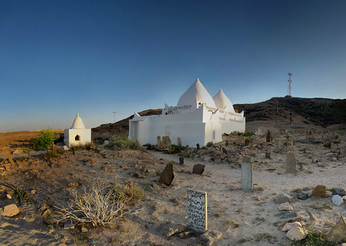
Oman - Mausolée de Bin Ali

Oman’s unique story reveals examples of great moral strength, courage, heroism, maritime skills, scholarship and hard work that have together moulded the Sultanate into its present form. By drawing our attention to the noble efforts of distinguished Omanis, historians have provided us with a deeper understanding of the great wealth of human experience that is at the foundation of modern Oman.

An understanding of Oman’s place at the heart of the Middle East and its relationship with neighbouring countries is central to understanding the international position of Oman today as well as its internal dynamics.

Oman occupies the far south-eastern corner of the Arabian Peninsula, its geographical boundaries clearly defined by nature from earliest times.

The earliest Stone Age settlement discovered in Oman is in the Wattaya district and dates back more than 10,000 years.

Babylon and Assyria were among the first empires to control the Asian land trade from the Arabian Gulf to the eastern shores of the Mediterranean. Later the Persian Empire expanded to gain influence over a vast area and control the region’s trade.

The rule of the Imams in Oman began in the eighth century C.E. Ibn Masoud was elected as the first imam in 751 and his reign lasted for four centuries until 1154. The Oman of the Imams was in the Nabhan period between the thirteenth and fifteenth centuries AD; attempts to revive the Imamate in Oman were renewed in the fifteenth century but these attempts failed.

Between 1498 to 1507, after Portugal had occupied the trading ports of East Africa along with Aden, the Portuguese stranglehold, which lasted for more than a century and a half, was to fail because of Oman’s spirited resistance and the election of Imam Nasir bin Murshid to the Imamate in 1624 AD.

The Portuguese possessions in India suffered tremendously from the Omani strikes. Portuguese and Omanis engaged in bloody battles for the control of East Africa, until the entire East African shore from Mombassa to Kilwa fell under Omani control. In 1698 AD the Omanis conquered Mombassa and then entered Pemba, Zanzibar and Patta, Mozambique was the only country that resisted the Omani Arab fleet, and it stayed under Portuguese control until the twentieth century.

Despite repeated attempts from 1737-1744 AD, the Persian invasions were not to achieve their objective of subduing Oman because of the valiant resistance put up by the Omanis. Oman’s heroic resistance staved off the Persian invasion in that period and their ultimate victory is owing to the leadership of Ahmed bin Said Al-Busaidi who succeeded in ousting the Persians from Oman and was elected Imam in 1744 AD,

In 1970 His Majesty Sultan Qaboos bin Said, the Crowning Glory of Oman, inaugurated the renaissance and modern age of Oman

"A journey of a thousand miles must begin with a single step." -- Lao Tzu
Copyright © Demetrios the Traveler


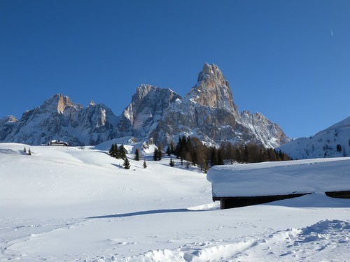
San Martino di Castrozza, ITALY

A tourist mecca, the Dolomites are famous for skiing in the winter months and mountain climbing, daily excursions, climbing and Base Jumping, as well as paragliding and hang gliding in summer and late spring/early autumn.[citation needed] Free climbing has been a tradition in the Dolomites since 1887, when 17-year-old Georg Winkler soloed the first ascent of the pinnacle Die Vajolettürme. The main centres include: Rocca Pietore alongside the Marmolada glacier, which lies on the border of the Trentino-Alto Adige/Südtirol and Veneto regions, the small towns of Alleghe, Falcade, Auronzo, Cortina d'Ampezzo, and the villages of Arabba, Urtijëi and San Martino di Castrozza, as well as the whole of the Fassa, Gardena and Badia Valleys.
In the first week in July, the Maratona dles Dolomites, an annual single-day road bicycle racing race covering seven mountain passes of the Dolomites, is staged.

"A journey of a thousand miles must begin with a single step." -- Lao Tzu
Copyright © Demetrios the Traveler


Monday, March 29, 2010

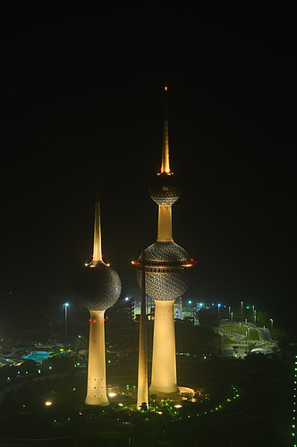
Kuwait Towers...


The Kuwait Towers are three towers of reinforced concrete in Kuwait City. The main tower is 187 metres high and serves as a restaurant and water tower. It also has a Viewing Sphere which rises to 123 meters above sea level and completes a full turn every 30 minutes. The second tower is 145.8 metres high and serves as a water tower. The third tower houses equipment to control the flow of electricity and illuminates the two larger towers. The towers hold 4,500 cubic meters of water. The towers were designed by Sune Lindström and Malene Björn and were built by Energoprojekt, a company from Belgrade, Yugoslavia. They opened to the public in March of 1979. The towers were heavily damaged by the Iraqis during their occupation of Kuwait from 1990 to 1991. In 1992, after the liberation of Kuwait City during the First Gulf War, Vic Clarke of Nottingham UK abseiled the Kuwait Water Towers during structural surveys. Mr. Clarke was introduced into Kuwait by Mr. Michael Stewart, of the Stewart Group International, also from Nottingham UK. There was substantial shell and bullet damage to the towers' exteriors. The interior damage was mainly to electrical gear, mostly lift equipment. Some of the large triangular glazed panels shown in the photograph were also damaged by shell fire.
"A journey of a thousand miles must begin with a single step." -- Lao Tzu
Copyright © Demetrios the Traveler


Sunday, March 28, 2010

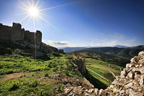
Το κάστρο της Λάρισσας... στο Αργος


Το κάστρο έχει υψόμετρο 289 μ. Οικοδομήθηκε κατά τους προϊστορικούς χρόνους και είναι νεότερο από τις οχυρώσεις της Ασπίδος. Η βάση του σε ορισμένα σημεία έχει ογκόλιθους, που μας θυμίζουν τα κυκλώπεια τείχη. Τον 5ο και 6ο αι. οι Αργείοι επισκευάζουν και συμπληρώνουν το τείχος, ακολουθώντας τα παλαιότερα ίχνη. Σημαντικά τμήματα της εποχής εκείνης σώζονται στο βόρειο και δυτικό τμήμα.

Τον 10ο αι. μ.Χ. κτίστηκε το μεσαιωνικό κάστρο. Τον 13ο αι. το ανανέωσαν οι Φράγκοι, τον 15ο αι. το συμπλήρωσαν οι Ενετοί και αργότερα οι Τούρκοι έκαναν τις δικές τους προσθήκες. Όλοι όσοι το διαφέντεψαν, Έλληνες και μη, φρόντισαν ν’ αφήσουν τα ίχνη της οχυρωματικής τους τέχνης στο επιβλητικό μνημείο, που δεσπόζει στην πεδιάδα του Άργους.
Κηρύχθηκε διατηρητέο μνημείο το 1992 (ΦΕΚ 28 Α/1922).
"A journey of a thousand miles must begin with a single step." -- Lao Tzu
Copyright © Demetrios the Traveler


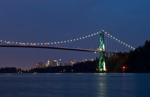
Lights on - Lions Gate Bridge, Vancouver

The Lions Gate Bridge, officially known as the First Narrows Bridge, is a suspension bridge that crosses the first narrows of Burrard Inlet and connects the City of Vancouver, British Columbia, to the North Shore municipalities of the District of North Vancouver, the City of North Vancouver, and West Vancouver. The term "Lions Gate" reflects the Lions, a pair of mountain peaks north of Vancouver.
The total length of the bridge including the north viaduct is 1,823 metres (5,890 feet). The length including approach spans is 1,517.3 m (4,978 ft), the main span alone is 473 m (1,550 ft), the tower height is 111 m (364 ft), and it has a ship's clearance of 61 m (200 ft). Prospect Point in Stanley Park offered a good high south end to the bridge, but the low flat delta land to the north required construction of the extensive North Viaduct.
The bridge has three reversible lanes, the use of which is indicated by signals. The centre lane changes direction to accommodate for traffic patterns. The traffic volume on the bridge is 60,000 - 70,000 vehicles per day. Trucks exceeding 13 tonnes (14.3 tons) are prohibited, as are vehicles using studded tires. The bridge forms part of Highways 99 and 1A.
On 24 March 2005, the Lions Gate Bridge was designated a National Historic Site of Canada.

"A journey of a thousand miles must begin with a single step." -- Lao Tzu
Copyright © Demetrios the Traveler


Umayyad Mosque, After © WWF Syria.

The Ummayad Mosque, also known as the Grand Mosque of Damascus (Arabic: جامع بني أمية الكبير, transl. Ğām' Banī 'Umayyah al-Kabīr), is one of the largest and oldest mosques in the world. Located in one of the holiest sites in the old city of Damascus, it is of great architectural importance.
After the Arab conquest of Damascus, the mosque was built on the Christian basilica dedicated to John the Baptist since the time of the Roman emperor Constantine I. The mosque holds a shrine which still today contains the head of John the Baptist (Yahya), honored as a prophet by both Christians and Muslims alike. There are also many important landmarks within the mosque for the Shī‘ah, among them is the place where the head of Husayn (the grandson of Muhammad) was kept on display by Yazīd I. There is also the tomb of Saladin, which stands in a small garden adjoining the north wall of the mosque.
In 2001 Pope John Paul II visited the mosque, primarily to visit the relics of John the Baptist. It was the first time a pope paid a visit to a mosque.


"A journey of a thousand miles must begin with a single step." -- Lao Tzu
Copyright © Demetrios the Traveler


Saturday, March 27, 2010

Snorkeling With A Sea Turtle


Snorkeling With A Sea Turtle, originally uploaded by Marc Shandro.

Nicola finds a sea turtle on her first snorkeling experience!

Our special "one kid at a time" trip with dad started with Morgan when she was 11. She chose to see Florida -- Disney World, Cape Canaveral and Merritt Island Wildlife Refuge. When Aaron turned 11 he said "I want to see the Grand Canyon", so that's where the two of us went -- for a two week road trip through Arizona and New Mexico (you can see some of those pictures in this set: www.flickr.com/photos/mshandro/sets/72057594127634638/. early on in my Flickr days.

For Nicola's trip, she chose to see Hawaii. We spent 2 weeks exploring the Big Island together in February 2010 and had a wonderful time! We stayed close to Kahalu'u Beach Park near Kona where the snorkeling here is "one of the nicer spots on the Big Island" (as mentioned in the Big Island Revealed guide book -- recommended).

I've been away from the Flickr scene for too long now! I'll slowly put some more up from this Hawaii trip... when I get back from San Francisco with Morgan. Now we're starting a Grade 12 tradition...

"A journey of a thousand miles must begin with a single step." -- Lao Tzu
Copyright © Demetrios the Traveler


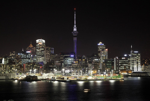
Auckland New Zealand


The Auckland metropolitan area (commonly pronounced /ˈɔːk.lənd/), in the North Island of New Zealand, is the largest and most populous urban area in the country with a population approaching 1.4 million residents, 31 percent of the country's population.
Demographic trends indicate that it will continue to grow faster than the rest of the country. Increasingly cosmopolitan, Auckland also has the largest Polynesian population of any city in the world, and has seen many people of Asian ethnicity move there in the last two decades. In Māori Auckland's name is Tāmaki-makau-rau, or the transliterated version of Auckland, Ākarana.
The 2009 Mercer Quality of Living Survey ranked Auckland 4th place in the world on its list, while The Economist's World's Most Livable Cities index of 2010 ranked Auckland in 10th place. In 2008, Auckland was classified as an Alpha-City in the World Cities Study Group’s inventory by Loughborough University, the only one in the country.
Auckland lies between the Hauraki Gulf of the Pacific Ocean to the east, the low Hunua Ranges to the south-east, the Manukau Harbour to the south-west, and the Waitakere Ranges and smaller ranges to the west and north-west. The central part of the urban area occupies a narrow isthmus between the Manukau Harbour on the Tasman Sea and the Waitemata Harbour on the Pacific Ocean. It is one of the few cities in the world to have harbours on two separate major bodies of water.
"A journey of a thousand miles must begin with a single step." -- Lao Tzu
Copyright © Demetrios the Traveler


Friday, March 26, 2010

Japan the strange country


Japan-The Strange Country (English ver.) from Kenichi on Vimeo.
This is my final thesis project. I created info-graphic, motion piece. My objective is to make Japanese people to think about that everything happening here in Japan, isn't that normal. So I created this video from foreigner's point of view, rather than Japanese people's point of view.


Both English and Japanese versions are available.


By the way, please don't call me racist, because I am one of short, small eyes Japanese ;P


大学の卒業制作で制作した映像です。(英語版)

日本で生活していると、当たり前すぎて気づかない「不思議な事実」を、海外で生活した経験も生かし、外国人の視点から統計とともに映像化しました。

笑いつつも、「なんか不思議だな」と考えてもらえれば幸いです。

日本語版と英語版があります。


"A journey of a thousand miles must begin with a single step." -- Lao Tzu
Copyright © Demetrios the Traveler


Thursday, March 25, 2010

Bled, Slovenia


Iglesia de María, originally uploaded by Pilar Azaña.
Bled is a municipality in northwestern Slovenia in the region of Upper Carniola. The area within the Julian Alps is a popular tourist destination.
Bled is known for the glacial Lake Bled, which makes it a major tourist attraction. Perched on a rock overlooking the lake is the iconic Bled Castle. The town is also known in Slovenia for its vanilla-and-cream pastry called kremna rezina or kremšnita.
Naturopath Arnold Rikli (1823–1906) from Switzerland contributed significantly to the development of Bled as a health resort in the 2nd half of the 19th century. Due to its mild climate, Bled has been visited by aristocratic guests from all across the world. Today it is an important convention centre and tourist resort, offering a wide range of sport activities (golf, fishing, horseback-riding) and is a starting point for mountain treks and hikes especially within the nearby Triglav National Park.
A small island in the middle of the lake is home to the Assumption of Mary Pilgrimage Church; visitors frequently ring its bell for good luck. Human traces from prehistory have been found on the island. Before the church was built, there was a temple consecrated to Živa, the Slavic goddess of love and fertility. One can get to the island on a traditional wooden row barge called Pletna. The island on Lake Bled has 99 steps. A local tradition at weddings is for the husband to carry his new bride up these steps, during which the bride must remain silent.

Knossington St Peter's church, Leicestershire, UK


Knossington is a thriving community, set in the rolling Leicestershire countryside. The village is located 8 miles from Melton Mowbray and 4 miles from Oakham. The Fox & Hounds provides a good centre for social life in Knossington, as does the Village Hall and the CofE Church. All 3 attractions are conveniently located towards the centre of the village.

Although the residents of Knossington are increasingly travelling away from the village to work on a daily basis, farming remains a primary industry within the village.

Knossington Grange is a major employer in the village and the Special Needs school is considered to be a centre of excellence for pupils (boys only to the age of 16 years) who display Emotional and Behaviourial Difficulties.

The Fox & Hounds is open all day serving excellent food & a full bar service.

Salzburg, Austria


Salzburgo, originally uploaded by Pilar Azaña.
Salzburg (Austro-Bavarian: Såizburg; literally: "Salt Castle") is the fourth-largest city in Austria and the capital of the federal state of Salzburg. Salzburg's "Old Town" (Altstadt) with its world famous baroque architecture is one of the best-preserved city centres north of the Alps, and was listed as a UNESCO World Heritage Site in 1997. The city is noted for its Alpine setting. It is the birthplace of 18th-century composer Wolfgang Amadeus Mozart. In the mid-20th century, the city was the setting for parts of the musical and film The Sound of Music, which also features famous landmarks in Austria. With three universities, Salzburg is filled with the liveliness of a large student population.

Praslin, Seychelles


Praslin, Seychelles, originally uploaded by bodji.
Praslin is the second largest island (38 km²) of the Seychelles, lying 44 km north east of Mahé. Praslin has a population of around 6,500 people and comprises two administrative districts; Baie Sainte Anne and Grand' Anse (Praslin). The main settlements are the Baie Ste Anne, Anse Volbert and Grand' Anse.
It was named Isle de Palmes by explorer Lazare Picault in 1744. During that time it was used as a hideaway by pirates and Arab merchants. In 1768 it was renamed Praslin in honor of French diplomat César Gabriel de Choiseul, duc de Praslin.
Praslin is known as a tourist destination with several hotels and resorts, as well as a number of beaches such as Anse Lazio and Anse Georgette. It also has substantial tracts of tropical forests with birds such as the endemic Seychelles Bulbul and the Seychelles Black Parrot. The beautiful Vallée de Mai Nature Preserve is known for the unique coco de mer and vanilla orchids. It has been reported that General Charles George Gordon of Khartoum (1833-1885) was convinced that Vallée de Mai was the Biblical "Garden of Eden".
Praslin is home to Praslin Island Airport, while surrounding islands include Curieuse Island, La Digue, Cousin Island, Cousine Island and Aride Island. There are also a few near offshore islets including Round Island (.193 km²) and Chauve Souris (.007 km²); both of which have hotel accommodations.

Ruins of the Carmo Convent, Lisbon, Portugal


The Carmo Convent (Portuguese: Convento da Ordem do Carmo) is a monument located in the city of Lisbon, in Portugal. The mediaeval convent was ruined in the 1755 Lisbon Earthquake, and the ruins of its Gothic church (the Carmo Church or Igreja do Carmo) are the main trace of the great earthquake still visible in the city.
The Carmo Convent is located in the Chiado neighbourhood, on a hill overlooking the Rossio square and facing the Lisbon Castle hill. It is located in front of a quiet square (Carmo Square), very close to the Santa Justa Lift.
Nowadays the ruined Carmo Church is used as an archaeological museum (the Museu Arqueológico do Carmo or Carmo Archaeological Museum).

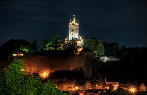
Wilhelmsturm in Dillenburg , Germany

Dillenburg is a town in Hesse's Gießen region in Germany. The town was formerly the seat of the old Dillkreis district, which is now part of the Lahn-Dill-Kreis.
It is located on the German-Dutch holiday road called the Oranier-Route, joining towns, cities and regions associated with the House of Orange-Nassau, as well as on the German Framework Road.
Dillenburg had its first documentary mention in 1254. Dillenburg was the ancestral seat of the Orange branch of the House of Nassau. Dillenburg Castle was built on top of the peak now called the Schlossberg in the late 13th or early 14th century. There are no pictures of this castle, however, as it was wooden, and was destroyed in the Dernbacher Feud.
From his stately home in exile, William I of Orange-Nassau, who was born in Dillenburg, organized the Dutch resistance against Spain (1567-1572), which still occasions regular Dutch royal visits to the town to this day. The land was administered by the presidents of the House of Nassau-Dillenburg. One of the last presidents was Georg Ernst Ludwig Freiherr von Preuschen von und zu Liebenstein (born 1727 in Diethardt; died 1794 in Bad Ems). In the Seven Years' War, the stately home was destroyed (1760), and Wilhelmstraße (a street) was built out of the remains. In 1875, the Wilhelmsturm (tower), views from which can be seen in this article, was completed on the Schlossberg. It is today the town's landmark. The "casemates" under the former stately home are among the biggest defensive works in Europe. They have been partly excavated and may be toured.
In the 19th century came the Industrial Revolution with the building of the Gießen-Cologne railway line – called the Sieg-Dill line – and the use of iron ore found on the Lahn, Dill and Sieg. Many mines, foundries and metalworking operations came into being in the region. In this time, many railway branchlines were built from Dillenburg to, among other places, Gönnern and Ewersbach. These lines have all been abandoned now. The line to Gönnern was abandoned in 1987 and torn up. The railway depot, so useful in the time of steam traction, was shut down in 1983.
In the Second World War, Dillenburg became a target of Allied attacks with its now closed marshalling yard. Ore mining became ever less profitable and in 1968, the last blast furnace, in Oberscheld, ceased operations.

"A journey of a thousand miles must begin with a single step." -- Lao Tzu
Copyright © Demetrios the Traveler


Monday, March 22, 2010

Astana, Kazakhstan


Astana (Kazakh: Астана / Astana / استانا), formerly known as Akmola (Kazakh: Ақмола / Aqmola, until 1998), Tselinograd (Russian: Целиноград, until 1992) and Akmolinsk (Russian: Акмолинск, until 1961), is the capital and second largest city (after Almaty) of Kazakhstan, with an officially estimated population of 750,700 as of November 2008. It is located in the north-central portion of Kazakhstan, within Akmola Province, though politically separate from the rest of the province.
The current mayor of Astana is Imangali Tasmagambetov. He was appointed on April 4, 2008.


"A journey of a thousand miles must begin with a single step." -- Lao Tzu
Copyright © Demetrios the Traveler


Sunday, March 21, 2010

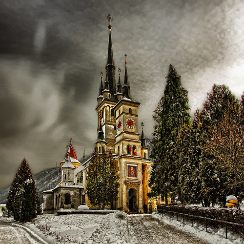
Sf. Nicholas, Brasov - Romania


Sf. Nicholas, originally uploaded by 23gxg.

Braşov (Romanian pronunciation: [braˈʃov]; German: Kronstadt; Hungarian: Brassó; Medieval Latin: Brassovia or Corona; 1950-1960: Oraşul Stalin) is a city in Romania and the capital of Braşov County, with a population of 284,596, according to the 2002 census, is the 8th largest Romanian city.
Braşov is located in the central part of the country, about 166 km from Bucharest. It is surrounded by the Southern Carpathians, and is part of the Transylvania region.
The city is notable for hosting the Golden Stag International Music Festival.

Saint Nicholas Church (Romanian: Biserica Sfântul Nicolae) is a Romanian Orthodox church in Braşov, dominating the historic district of Şchei.
The church was established in 1292. It was mentioned in a Papal bull issued in 1399 by Pope Boniface IX. Starting in 1495, the church was rebuilt in stone by the locals, with help from Vlad Călugărul, Voivode (Prince) of Wallachia. More help was provided around 1512 by Neagoe Basarab.
Initially built in the Gothic style, it was later redone in the Baroque style. It has frescoes painted by the renowned muralist Mişu Popp.
Next to St. Nicholas Church is the First Romanian School (started in 1583), and a statue of Coresi. Nearby is a cemetery, where Ioan Meşotă, Aurel Popovici, Vasile Saftu, and Nicolae Titulescu are buried.

"A journey of a thousand miles must begin with a single step." -- Lao Tzu
Copyright © Demetrios the Traveler


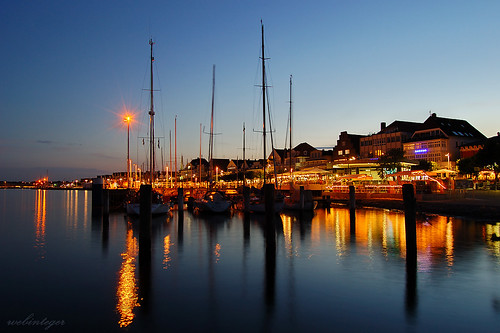
Travemünde, Schleswig-Holstein, Germany


Night Lights, originally uploaded by globalindex.

Travemünde is a borough of Lübeck, Germany, located at the mouth of river Trave in Lübeck Bay. Travemünde arose out of a stronghold placed here by Henry the Lion, Duke of Saxony, in the 12th century to guard the mouth of the Trave, and the Danes subsequently strengthened it. It became a town in 1317 and in 1329 passed into the possession of the free city of Lübeck, to which it has since belonged. Its fortifications were demolished in 1807.
Travemünde is an old seaside resort (since 1802) and Germany's largest ferry port at the Baltic Sea with destinations to Sweden, Finland, Latvia and Estonia. The lighthouse is from 1539 and the oldest German lighthouse at the Baltic coast. Another attraction of Travemünde is the Flying P-Liner Passat, a museum ship anchored in the mouth of river Trave.
The annual Travemünder Woche is a traditional sailing race week in Northern Europe. The annual Sand festival in Travemünde is known as the Sand World.

"A journey of a thousand miles must begin with a single step." -- Lao Tzu
Copyright © Demetrios the Traveler


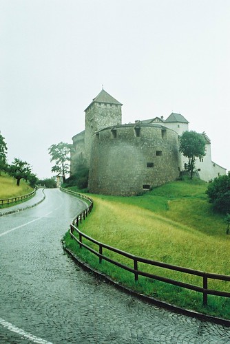
Vaduz castle, Liechtenstein


attempted invasion, originally uploaded by mind your eyes.

Vaduz is the capital of the principality of Liechtenstein and the seat of the national parliament. The town, located along the Rhine, has about 5,100 inhabitants (as of 2009), most of whom are Roman Catholic. Its cathedral is the seat of a Roman Catholic archbishop.
While Vaduz is better known internationally, it is actually not the largest town in the principality: neighbouring Schaan has a greater population.
The most prominent landmark of Vaduz is Vaduz Castle, the home of the reigning prince of Liechtenstein and the Liechtenstein princely family. The castle is visible from almost any location in Vaduz, being perched atop a steep hill in the middle of the city. The Cathedral of St. Florin, Government House and City Hall are also well-known landmarks, displaying the various styles and periods of architecture that the city is known for.

"A journey of a thousand miles must begin with a single step." -- Lao Tzu
Copyright © Demetrios the Traveler


Shanghai skyline, China


skyline, originally uploaded by ༺lifemage༻.

Shanghai (Chinese: 上海 Pinyin: Shànghǎi, Shanghainese: Zånhae) is the largest city in China and the largest city proper in the world, with a population of nearly 14 million.
Originally a fishing and textiles town, Shanghai grew to importance in the 19th century due to its favorable port location and as one of the cities opened to foreign trade by the 1842 Treaty of Nanking. The city flourished as a center of commerce between east and west, and became a multinational hub of finance and business by the 1930s. After 1990, the economic reforms introduced by Deng Xiaoping resulted in intense re-development and financing in Shanghai, and in 2005 Shanghai became the world's largest cargo port. Shanghai will hold the Expo 2010, the largest event to be held in China since the 2008 Summer Olympics.
The city is a tourist destination renowned for its historical landmarks such as the Bund and City God Temple, its modern and ever-expanding Pudong skyline including the Oriental Pearl Tower, and its new reputation as a cosmopolitan center of culture and design. Today, Shanghai is the largest center of commerce and finance in mainland China, and has been described as the "showpiece" of the world's fastest-growing major economy.

"A journey of a thousand miles must begin with a single step." -- Lao Tzu
Copyright © Demetrios the Traveler


Stockholm by Night, Sweden


Stockholm by Night, originally uploaded by diesmali.

Stockholm is the capital and the largest city of Sweden. It is the site of the national Swedish government, the Riksdag (parliament), and the official residence of the Swedish monarch as well as the prime minister. Since 1980, the monarch has resided at Drottningholm Palace outside of Stockholm and uses the Royal Palace of Stockholm as his workplace and official residence. As of 2009, the Stockholm metropolitan area is home to approximately 22% of Sweden's population, and contributes 28% of Sweden's gross domestic product.
Stockholm is the most populous city in Sweden with a population of 829,417 in the municipality (2009), 1.25 million in the urban area (2005), and 2 million in the metropolitan area (2009).
Founded circa 1250, Stockholm has long been one of Sweden's cultural, media, political, and economic centres. Its strategic location on 14 islands on the south-central east coast of Sweden at the mouth of Lake Mälaren, by the Stockholm archipelago, has been historically important. Stockholm has been nominated by GaWC as a global city, with a ranking of Alpha. In The 2008 Global Cities Index, Stockholm ranked 24th in the world, 10th in Europe, and first in Scandinavia. Stockholm is known for its beauty, its buildings and architecture, its abundant clean and open water, and its many parks. It is sometimes referred to as Venice of the North. Stockholm is the second most visited city in the Nordic countries, with around one million visitors in 2006.
The city's oldest section is "Gamla Stan" (Old Town), located on the original small islands of the city's earliest settlements and still featuring the medieval street layout. Some notable buildings of Gamla Stan are the large German Church (Tyska kyrkan) and several mansions and palaces: the Riddarhuset (the House of Nobility), the Bonde Palace, the Tessin Palace and the Oxenstierna Palace. The oldest building in Stockholm is the Riddarholmskyrkan from the late 13th century. After a fire in 1697 when the original medieval castle was destroyed, Stockholm Palace was erected in a baroque style. Storkyrkan Cathedral, the episcopal seat of the Bishop of Stockholm, stands next to the castle. It was founded in the 13th century but is clad in a baroque exterior dating to the 18th century.
As early as the 15th century, the city had expanded outside of its original borders. Some pre-industrial, small-scale buildings from this era can still be found in Södermalm. During the 19th century and the age of industrialization Stockholm grew rapidly, with plans and architecture inspired by the large cities of the continent such as Berlin and Vienna. Notable works of this time period include public buildings such as the Royal Swedish Opera and private developments such as the luxury housing developments on Strandvägen.
In the 20th century, a nationalistic push spurred a new architectural style inspired by medieval and renaissance ancestry as well as influences of the Jugend/Art Nouveau style. A key landmark of Stockholm, the Stockholm City Hall, was erected 1911-1923 by architect Ragnar Östberg. Other notable works of these times are the Stockholm Public Library and the Forest Cemetery, Skogskyrkogården.
In the 1930s modernism characterized the development of the city as it grew. New residential areas sprang up such as the development on Gärdet while industrial development added to the growth, such as the KF manufacturing industries on Kvarnholmen located in the Nacka Municipality. In the 1950s, suburban development entered a new phase with the introduction of the Stockholm metro. The modernist developments of Vällingby and Farsta were internationally praised. In the 1960s this suburban development continued but with the aesthetic of the times, the industrialised and mass-produced blocks of flats received a large amount of criticism.
At the same time that this suburban development was taking place, the most central areas of the inner city were being redesigned, known as Norrmalmsregleringen. Sergels Torg, with its five high-rise office towers was created in the 1960s, followed by the total clearance of large areas to make room for new development projects. The most notable buildings from this period is the ensemble of the House of Culture, City Theatre and National Bank at Sergels Torg, designed by architect Peter Celsing.
In the 1980s the planning ideas of modernism were starting to be questioned, resulting in suburbs with a denser planning, such as Skarpnäck. In the 1990s this idea was taken further with the development of and old industrial area close to the inner city, resulting in a sort of mix of modernistic and urban planning in the new area of Hammarby Sjöstad.
The municipality has appointed an official "board of beauty" called "Skönhetsrådet" to protect and preserve the beauty of the city.
Stockholm's architecture provided the inspiration for Japanese director Hayao Miyazaki as he sought to evoke an idealized city untouched by World War. His creation, called Koriko, draws directly from what Miyazaki felt was Stockholm's sense of well-established architectural unity, vibrancy, independence, and safety.
One of the most unusual pieces of "architecture" in Stockholm is the Jumbohostel, housed in a converted Boeing 747 located at Stockholm-Arlanda Airport.

"A journey of a thousand miles must begin with a single step." -- Lao Tzu
Copyright © Demetrios the Traveler


Buenos Aires, Argentina

Buenos Aires is the capital and largest city of Argentina, currently the second-largest metropolitan area in South America, after São Paulo. It is located on the western shore of the estuary of the Río de la Plata, on the southeastern coast of the South American continent. The city of Buenos Aires is not part of Buenos Aires Province, nor is it its capital; rather, it is an autonomous federal district. Greater Buenos Aires is the third-largest conurbation in Latin America, with a population of around 13 million. Buenos Aires is considered an Alpha World City listed by the Loughborough University group's (GaWC) 2008 inventory.
After the internal conflicts of the 19th century, Buenos Aires was federalised and removed from Buenos Aires Province in 1880. The city limits were enlarged to include the former towns of Belgrano and Flores, which are both now neighbourhoods of the city.
Buenos Aires (English: Fair Winds or Good Air (see Names of Buenos Aires)) was originally named after the sanctuary of "Nostra Signora di Bonaria" (Italian for "Our Lady of Bonaria") in Cagliari, Sardinia. In the 1994 constitution the city became autonomous, hence its formal name: Ciudad Autónoma de Buenos Aires, in English, Autonomous City of Buenos Aires. People from Buenos Aires are referred to as porteños (people of the port).

"A journey of a thousand miles must begin with a single step." -- Lao Tzu
Copyright © Demetrios the Traveler


Thursday, March 18, 2010

Vacation Planner 2010

Check out this SlideShare Presentation: "A journey of a thousand miles must begin with a single step." -- Lao Tzu
Copyright © Demetrios the Traveler


Adventures of a travelling blogger

Check out this SlideShare Presentation:
"A journey of a thousand miles must begin with a single step." -- Lao Tzu
Copyright © Demetrios the Traveler


Tuesday, March 16, 2010

Harrisburg, Pennsylvania, USA


Harrisburg, originally uploaded by visitPA.

Harrisburg is the capital of the Commonwealth of Pennsylvania, in the United States of America. As of the 2000 census, the city had a population of 48,950, making it the ninth largest city in Pennsylvania, after Philadelphia, Pittsburgh, Allentown, Erie, Reading, Scranton, Bethlehem and Lancaster.
Harrisburg is the county seat of Dauphin County and lies on the east bank of the Susquehanna River, 105 miles (169 km) west-northwest of Philadelphia. The Harrisburg-Carlisle Metropolitan Statistical Area, which includes Dauphin, Cumberland, and Perry counties, had a population of 509,074 in 2000. A July 1, 2007 estimate placed the population at 528,892, making it the fifth largest Metropolitan Statistical Area in Pennsylvania after Philadelphia, Pittsburgh, Allentown-Bethlehem-Easton (the Lehigh Valley), and Scranton-Wilkes Barre. The Harrisburg-Carlisle-Lebanon Combined Statistical Area, including both the Harrisburg-Carlisle and Lebanon Metropolitan Statistical Areas, had an estimated population of 656,781 in 2007.
Harrisburg played a notable role in American history during the Westward Migration, the American Civil War, and the Industrial Revolution. During part of the 19th century, the building of the Pennsylvania Canal and later the Pennsylvania Railroad allowed Harrisburg to become one of the most industrialized cities in the Northeastern United States. The U.S. Navy ship USS Harrisburg, which served from 1918 to 1919 at the end of World War I, was named in honor of the city.
In the mid-to-late 20th century, the city's economic fortunes have fluctuated with its major industries consisting of government, heavy manufacturing including the production of steel, agriculture (the greater Harrisburg area is at the heart of the fertile Pennsylvania Dutch Country), and food services (nearby Hershey is home of the chocolate maker, located just 10 miles east of Harrisburg).
In 1981, following contractions in the steel and dairy industries, Harrisburg was declared the second most distressed city in the nation. The city subsequently experienced a resurgence under its former mayor Stephen R. Reed, with nearly $3 billion in new investment realized during his lengthy tenure.
The Pennsylvania Farm Show, the largest free indoor agriculture exposition in the United States, was first held in Harrisburg in 1917 and has been held there every January since then. Harrisburg also hosts an annual outdoor sports show, the largest of its kind in North America, as well as an auto show, which features a large static display of new as well as classic cars and is renowned nation-wide. Harrisburg is also known for the infamous Three Mile Island accident, which occurred in 1979 in nearby Middletown.


"A journey of a thousand miles must begin with a single step." -- Lao Tzu
Copyright © Demetrios the Traveler


Monday, March 15, 2010

Cliffs of Moher - Ireland

THE CLIFFS OF MOHER
on the west coast of Ireland are one of the most outstanding coastal features of Ireland and bigest Tourist Attraction. The cliffs are located just south from the Village of Doolin. Rising slowly from Doolin they ascend to over 700 feet (213 metres) stretching south for nerarly five miles (8km) to Hags head.
Being almost vertical, their sheer drop into the heaving Atlantic ocean is a haven for sea birds. One can see the Aran Islands, Galway Bay, as well as The Twelve Pins and the Maum Turk Mountains to the north in Connemara and Loop Head to the South, the top is never tiresome.
The Cliffs of Moher is home to a hugh number of nesting seabirds. These include the Atlantic Puffin, Razorbuill, Chough and Common Gull. The area is designated as a Refuge for Fauna since 1988 and as a Special Protection Area for Birds (SPA) under the EU Birds Directive in 1989.

"A journey of a thousand miles must begin with a single step." -- Lao Tzu
Copyright © Demetrios the Traveler


Digg!


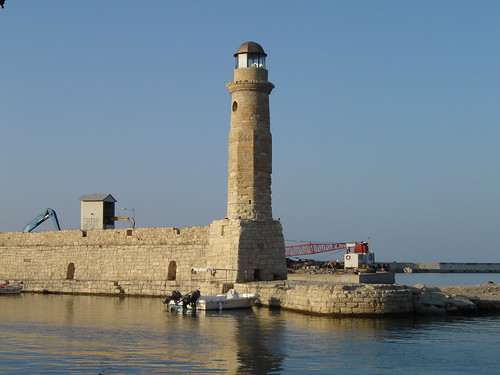
Rethymno lighthouse, Crete, Greece


Rethymno lighthouse, originally uploaded by Glikò.

Rethymno (Greek: Ρέθυμνο, pronounced ['reθimno], also Rethimno, Rethymnon, Réthymnon, and Rhíthymnos) is a city of approximately 40,000 people in Greece, the capital of Rethymno Prefecture in the island of Crete. It was built in antiquity (ancient Rhithymna and Arsinoe), even though was never a competitive Minoan center. It was, however, strong enough to mint its own coins and maintain urban growth. One of these coins is today depicted as the crest of the town with two dolphins in a circle.
This region as a whole is rich with ancient history, most notably through the Minoan civilisation centred at Kydonia east of Rethymno.

Rethymno itself began a period of growth when the Venetian conquerors of the island decided to put an intermediate commercial station between Heraklion and Chania, acquiring its own bishop and nobility in the process. Today's old town (palia poli) is almost entirely built by Venetians. It is one of the best preserved old towns in Crete.
The town still maintains its old aristocratic appearance, with its buildings dating from the 16th century, arched doorways, stone staircases, Byzantine and Hellenic-Roman remains, small Venetian harbor and narrow streets. The Venetian Loggia today houses the information office of the ministry of culture. The Wine Festival is held there annually at the beginning of July. Another festival is held on 7-8th of November, in memory of the destruction of Arkadi Monastery.
It has a large Venetian castle called the Fortezza, one of the best preserved castles in Crete. Other monuments include the Neratze mosque (the Municipal Odeon arts centre), the Great Gate (megali porta, Porta Guora), the Piazza Rimondi (Rimondi square) and the Venetian Loggia.
As part of the Crete, the town was also captured by Turks in 1600s and ruled more than 3 centuries. Turkish version of Rethymnon is Resmo. It was sanjak centre in Crete (Girit) Province during Ottoman rule.
Today its main income is from tourism, many new facilities having been built in the past 20 years. Agriculture is also notable, especially for olive oil and other Mediterranean products. It is also the base of the Philosophical School and the University Library of the University of Crete and the School of Social and Political Sciences having 8000 students on its University Campus per annum at "Galos", where the Academic Institute of Mediterranean Studies is situated. The city has an Archaeological Museum.


"A journey of a thousand miles must begin with a single step." -- Lao Tzu
Copyright © Demetrios the Traveler


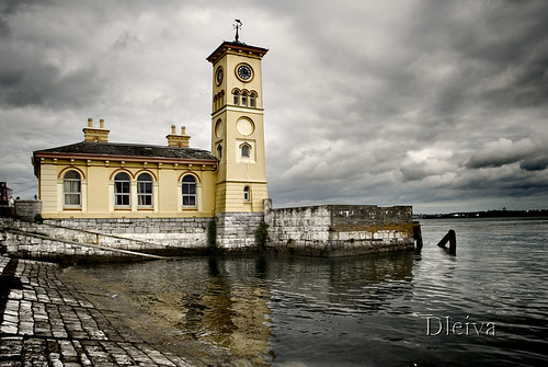
Cobh, Ireland


Cobh, Ireland, originally uploaded by dleiva.

Cobh (pronounced /ˈkoʊv/; Irish: An Cóbh, "cove") is a sheltered seaport town on the south coast of County Cork, Ireland with a approx population of around 28,639.
The locality, which had had several different Irish-language names, was first referred to as Cove ("The Cove of Cork") in 1750. It was renamed Queenstown in 1849 to commemorate a visit by Queen Victoria and so remained until the name Cobh (closer to the Irish spelling) was restored in 1922 with the foundation of the Irish Free State.
Cobh is located on the south shore of the Great Island in Cork Harbour, (reputed to be the second largest natural harbour in the world), on south-facing slopes overlooking the entrance to the harbour. Facing the town of Cobh are Spike Island and Haulbowline Island. On a high point in the town stands the Cobh Cathedral, St. Colman's, seat of the diocese of Cloyne.


"A journey of a thousand miles must begin with a single step." -- Lao Tzu
Copyright © Demetrios the Traveler


PUERTO BANUS - Málaga, Spain


PUERTO BANUS - Málaga., originally uploaded by canduela.

Puerto José Banús, more commonly known as Puerto Banús is a marina in Marbella, Spain on the Costa del Sol. It was built in 1970 by José Banús, a local property developer, as a luxury marina and shopping complex for the jet-set and the super rich.
The lavish opening of the complex in May 1970 was attended by, amongst others, the Aga Khan, film director Roman Polanski, Playboy founder Hugh Hefner, Dr. Christian Barnard (pioneer of the heart transplant), and Prince Rainier and Princess Grace of Monaco. A youthful Julio Iglesias was contracted to sing for the guests for the enormous sum of 125,000 pesetas. An army of 300 waiters from Seville served 50 pounds of beluga caviar to the 1,700 guests.
The focal point of Puerto Banus is the marina. It has berths for 915 boats, including those of the King of Saudi Arabia and several of the world's wealthiest individuals. Behind the harbour lie streets filled with bars, boutiques and nightclubs.
The marina has slips for boats and ships from 8 to 50 meters. Its surface area is 15 hectares, and its depth ranges from 3 to 6 meters within the marina, with 7.5 meters at its entrance. There is beach on each side of the marina. Many of the yachts moored within can enjoy an unobstructed view of La Concha mountain, one of the coast's landmarks.
José Banús himself was a developer with real estate holdings all along the coast. He was an intimate of Francisco Franco's and was called el constructor del régimen ("the regime's builder").
A three-ton statue of a rhinoceros by Salvador Dalí was placed in Puerto Banús in 2004. Officially known as Rinoceronte vestido con puntillas ("Rhinoceros dressed in lace"), Dalí created the sculpture in 1956 following the filming of his surrealist movie La aventura prodigiosa de la encajera y el rinoceronte ("The prodigious adventure of the lacemaker and the rhinoceros") in 1954.

"A journey of a thousand miles must begin with a single step." -- Lao Tzu
Copyright © Demetrios the Traveler


Digg!


Martinique — Overseas region of France


FISHERMEN BOATS |martinique|, originally uploaded by _loran_denim.

Martinique is an island in the eastern Caribbean Sea, with a land area of 1,128 km2 (436 sq mi). It is an overseas region of France, consisting of a single overseas department. To the northwest lies Dominica, to the south St Lucia, and to the southeast Barbados. As with the other overseas departments, Martinique is one of the twenty-six regions of France (being an overseas region) and an integral part of the Republic.
As part of France, Martinique is part of the European Union, and its currency is the euro. Its official language is French, although many of its inhabitants also speak Antillean Creole (Créole Martiniquais). Martinique is pictured on all euro banknotes, on the reverse at the bottom of each note, right of the Greek ΕΥΡΩ (EURO) next to the denomination.


"A journey of a thousand miles must begin with a single step." -- Lao Tzu
Copyright © Demetrios the Traveler


Digg!


King of the bay Diamant bay in Martinique


King of the bay, originally uploaded by guillaumeo.

Diamond Rock (Rocher du Diamant) is a 175 meter (574 feet) high basalt island located south of Fort-de-France, the main port of the Caribbean island of Martinique.
The uninhabited island is about three kilometers from Pointe Diamant. The island gets its name from the reflections that its sides cast at certain hours of the day, which evoke images of a precious stone. Its claim to fame is the role that it played in the Napoleonic Wars.
The rock is a volcanic plug, a remnant of the strong volcanic activity that affected the region some one million years ago.
However, a Captain Hansen of the Norwegian steamship Talsiman reported that on 13 May, 1902, he observed what he took to be a volcanic eruption from a hole in the rock. This was at the time of the devastating volcanic eruption Mount Pelée that destroyed Saint-Pierre. Hansen did not investigate further.
Like the other 47 islets that circle Martinique, the Rock has its own ecological characteristics. It is sunnier than the main island, drier, and subject to a long seasonal dry period. Today it is covered in undergrowth and cacti.
Relatively inaccessible and inhospitable, the island is uninhabited, which has permitted it to remain a sanctuary for a species that had been believed to be extinct.
A nature survey has suggested that Diamond Rock is probably the last refuge for a species of reptile once endemic to Martinique, the Couress grass snake (Liophis cursor).
Below water the Diamond Rock cavern, a deep triangular cave, is a popular attraction for scuba divers. The cave is said to contain prolific quantities of beautiful sea fans and corals, though strong currents make diving the island a risky venture.
The author John Fine reports that while diving he found one of the Rock's cannon that the French had toppled from the summit.

"A journey of a thousand miles must begin with a single step." -- Lao Tzu
Copyright © Demetrios the Traveler


Digg!


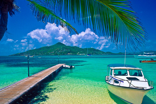
Islands of Saint Vincent and the Grenadines


PM, originally uploaded by islandfella.

Petit St. Vincent, known locally as PSV, is an island 40 statute miles (60 km) south of St. Vincent in the Grenadine islands. It consists of softly rolling hills spread over 113 acres (46 ha) surrounded mostly by two miles (3 km) of white sand beaches.
The island is privately owned. In the 1960s, friends Hazen Richardson and Douglas Terman discovered the island while sailing, and conceived the idea of making it an exclusive resort. Richardson oversaw the construction of the resort and operated it for 40 years; Terman went on to become a novelist.
PSV consists of 22 cottages and a central dining room, with staff housing and other support structures. It is a resort for a particular kind of person; the cottages are not air-conditioned, and have neither televisions nor telephones. However, the food, service, and other amenities are of a very high quality. Guests can take all meals in their cottages, and are otherwise guaranteed total privacy should they wish it.
Owner Haze Richardson died in a swimming accident in Costa Rica on Saturday February 2, 2008. His wife, Lynn Richardson, plans to continue managing the resort.

http://www.psvresort.com


"A journey of a thousand miles must begin with a single step." -- Lao Tzu
Copyright © Demetrios the Traveler


Digg!


Ghazanchetsots Cathedral, Shushi, Nagorno-Karabakh Republic


IMG_0378, originally uploaded by raffikojian.

Ghazanchetsots Cathedral (Armenian: Սուրբ Ամենափրկիչ Ղազանչեցոց Եկեղեցի), also known as the Cathedral of Christ the Savior and the Shushi Cathedral, is an Armenian church located in Shushi, Nagorno-Karabakh. It was built between 1868 and 1887 and has a facade of white limestone. Its architect, Simon Ter-Hakobyan, intended the church to resemble Etchmiadzin Cathedral. In front of the west entrance is a freestanding three-story bell tower, constructed in 1858. Large statues of angels blowing trumpets stood at each corner of the bell tower's second story. However, they were destroyed during the Nagorno-Karabakh War when Shushi was under Azeri control.
The cathedral has seen a number of uses over the years. Its use as a functioning church ended after the Shusha pogrom of 1920. During the Soviet period period it was used as a granary, and then as a garage. During the Nagorno-Karabakh War, Azerbaijani forces used the cathedral as a GRAD munitions storehouse until May 1992, when Shushi was captured by Armenian forces. In the years after that capture the church was repaired and renovated. Replica angel statues were made to replace the destroyed originals; an image of one forms part of the coat-of-arms of Shushi. In 1998 it was re-consecrated as a church, and it is the main cathedral and headquarters of the Armenian Apostolic Church's Diocese of Artsakh.

"A journey of a thousand miles must begin with a single step." -- Lao Tzu
Copyright © Demetrios the Traveler


Digg!


readers

labels and tags

Powered By Blogger