no comment!
Thursday, August 19, 2010
Tuesday, August 17, 2010
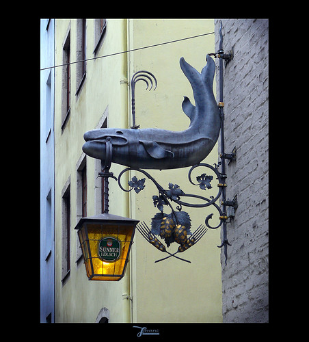
Altstadt, Cologne Germany
Innenstadt (German: Köln-Innenstadt) is a city district (Stadtbezirk) of the City of Cologne in Germany and the city's commercial and cultural center.
The district was established with the last communal land reform in 1975, and comprises Cologne's historic old town (Altstadt), the Gründerzeit era new town (Neustadt) plus the right-Rhenish district of Deutz. Innenstadt has about 127,000 inhabitants (as of December 2008) and covers an area of 16.4 square kilometres.
source & more info @: http://en.wikipedia.org/wiki/Innenstadt,_Cologne
Saturday, August 14, 2010
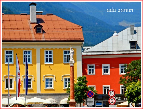
Lienz, east Tyrol Austria
Lienz is a medieval town in the Austrian state of Tyrol. It is the administrative centre of the Lienz district , which covers all of East Tyrol. Lienz is located at the confluence of the rivers Isel and Drava, between the Hohe Tauern mountain range in the north and the Gailtal Alps in the south. The municipality also includes the cadastral subdivision of Patriasdorf.
source & more @: http://en.wikipedia.org/wiki/Lienz
Downtown Calgary , Alberta Canada
Calgary is the largest city in the Province of Alberta, Canada. It is located in the south of the province, in an area of foothills and prairie, approximately 80 km (50 mi) east of the front ranges of the Canadian Rockies.
The city is located in the Grassland region of Alberta.
In 2006, the City of Calgary had a population of 988,193 making it the third-largest municipality in the country and largest in Alberta. The entire metropolitan area had a 2006 population of 1,079,310, making it the fifth-largest census metropolitan area (CMA) in Canada. In 2009, Calgary's metropolitan population was estimated at 1,230,248, raising its rank to fourth-largest CMA in Canada.
Located 294 km (183 mi) due south of Edmonton, statisticians define the narrow populated area between these cities as the "Calgary–Edmonton Corridor."
Calgary is the largest Canadian metropolitan area between Toronto and Vancouver.
Calgary is a destination for winter sports and ecotourism with a number of major mountain resorts near the city and metropolitan area. Economic activity in Calgary is mostly centered on the petroleum industry. Agriculture, tourism and high-tech industries also contribute to the city's economic growth. In 1988, Calgary became the first Canadian city to host the Olympic Winter Games.
Wednesday, August 11, 2010
Phipps Conservatory, Pittsburg PA USA
Tuesday, August 10, 2010
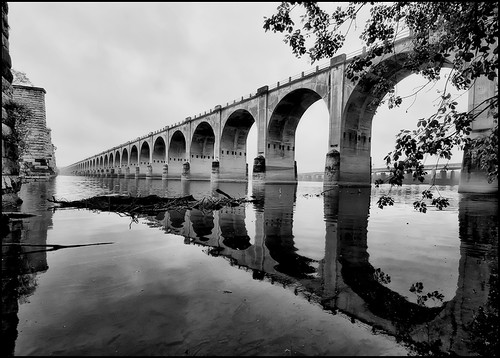
Harrisburg Rail Bridge, PA, USA
Harrisburg has been an important location for statewide transportation since selected as the capital of Pennsylvania in 1812. The canal system and subsequent development of railroads, highways and airlines in the early century played a key role in transforming Harrisburg into a commercial and distribution center for Pennsylvania and the East. The city is centrally located 80 miles north of Baltimore, 100 miles west of Philadelphia, and 100 miles north of Washington D.C.
source & more @: http://wikitravel.org/en/Harrisburg
Monday, August 9, 2010
High Street, Dunfermline Scotland UK
Dunfermline (Scottish Gaelic: Dùn Phàrlain) is a town in Fife which had official city status until 1970. It is located on high ground five miles from the northern shore of the Firth of Forth on the route of major road and rail crossings across the firth to Edinburgh and the south.
Dunfermline was an ancient capital of Scotland and is the burial place for many in the country's line of monarchs including Robert I and Saint Margaret. The poet Robert Henryson, one of the country's major literary figures, also lived in Dunfermline and was associated with its abbey. Ruins of the former monastic buildings around the abbey, now a parish church, include the remains of the royal palace and are an important tourist attraction.
In modern times, the most famous son of Dunfermline was the wealthy industrialist, businessman, and philanthropist Andrew Carnegie. He was the central figure in promoting its early twentieth century urban renewal and his financial legacy is still of major importance.
Traditional industries in Dunfermline's catchment area have principally involved textiles, engineering, defence and electronics. In more recent times this has begun to diversify into the service sectors, including tourism.
According to the recent population estimate (2006), the town has 45,462 people living within its boundaries, this is a substantial rise from the 41,508 people recorded living there in 2001 which has resulted from the major expansion of the town in the east. It also falls under the wider Dunfermline and West-Fife Local Plan area which has an overall total population of around 100,324
Sunday, August 8, 2010
Bruges, Flanders, Belgium
Bruges ( /ˈbruːʒ/ in English; Dutch: Brugge, [ˈbrʏʝə]) is the capital and largest city of the province of West Flanders in the Flemish Region of Belgium. It is located in the northwest of the country.
The historic city centre is a prominent World Heritage Site of UNESCO. It is egg-shaped and about 430 hectares in size. The area of the whole city amounts to more than 13,840 hectares, including 1,075 hectares off the coast, at Zeebrugge (meaning "Brugge aan Zee" or "Bruges on Sea"). The city's total population is 117,073 (1 January 2008), of which around 20,000 live in the historic centre. The metropolitan area, including the outer commuter zone, covers an area of 616 km² and has a total of 255,844 inhabitants as of 1 January 2008.
Along with a few other canal-based northern cities, such as Amsterdam, it is sometimes referred to as "The Venice of the North".
Bruges has a significant economic importance thanks to its port. At one time it was the "chief commercial city" of the world.
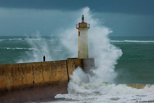
Audierne, Brittany, France
The harbour, formerly important to the local fishing industry, is now essentially a yacht port. Remaining of the fishery is an oyster farm, in which the delicacy can be bought.
Along the harbour stretches the town's main shopping area with its cafés, bars and restaurants, crêperies, boutiques, estate agents and holiday agencies, the town hall, the tourism office, and the regional bus stop. On Saturday mornings there is a farmers' market, which serves as a meeting place for natives and tourists alike.
Audierne is twinned with Penryn, Cornwall.
source and more info @: http://en.wikipedia.org/wiki/Audierne
and @ the official site: http://www.audierne.fr/
Saturday, August 7, 2010
Gößweinstein castle, Fränkische Schweiz, Bavaria, Germany
Gößweinstein is a municipality in the district of Forchheim in Bavaria in Germany.
The first record of the Goswinesteyn Castle is from 1076. Prior to 1102 the Hochstift Bamberg became the owner of the castle. The prince-bishop of Bamberg Friedrich Carl von Schönborn (ruled from 1729 until 1746) elevated Gößweinstein's status to a Market. During the Secularization in 1803, the area of the Hochstift Bamberg was transferred to Bavaria.
During the Bavarian territorial reforms in 1978, the formerly independent communities of Morschreuth, Wichsenstein, Behringersmühle, Kleingesee, Leutzdorf, Stadelhofen, Unterailsfeld and part of the community Tüchersfeld were integrated into Gößweinstein.
source and more info @: http://en.wikipedia.org/wiki/G%C3%B6%C3%9Fweinstein
and @ the official page: http://www.goessweinstein.de/
Friday, August 6, 2010
Crackpot Hall, Swaledale, North Yorkshire UK
 NY906008. There may have been a building on this site since the 1500s when ahunting lodge was maintained for Thomas, the first Baron Wharton, who visited the Dale occasionally to shoot the red deer. Survey work by the Yorkshire Dales National Park Authority has shown that the building has changed many times over the years. At one time it even had a heather or "ling" thatched roof.
Keld is the crossing point of the Coast to Coast Walk and the Pennine Way long distance footpaths at the head of Swaledale. Unfortunately it does not contain a shop. There was a Youth Hostel but this closed in October 2006; the building has since reopened as Keld Lodge, a hotel with bar and restaurant.
There is a series of four waterfalls close to Keld at a limestone gorge on the River Swale. These are Kisdon Force, East Gill Force, Catrake Force and Wain Wath Force.
Löderup, Ystad, Skåne, Sweden
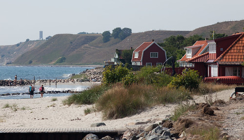
photo by: http://www.flickr.com/photos/dahlstroms/
Löderup is a locality situated in Ystad Municipality, Skåne County, Sweden with 558 inhabitants in 2005
"A journey of a thousand miles must begin with a single step." -- Lao Tzu Copyright © Demetrios the Traveler
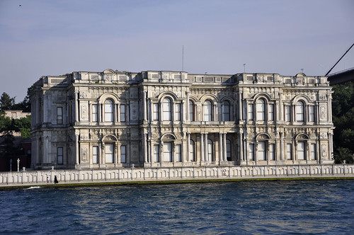
Beylerbeyi Sarayı, Istanbul, Turkey
The Beylerbeyi Palace — or Beylerbeyi Sarayı in Turkish (Beylerbey = "Lord of Lords") — is located in the Beylerbeyi neighbourhood of Istanbul, Turkey at the Asian side of the Bosphorus. An Imperial Ottoman summer residence built in the 1860s, it is now situated immediately north of the 1973 Bosphorus Bridge .
source and more info @: http://en.wikipedia.org/wiki/Beylerbeyi_Palace
Wednesday, August 4, 2010
Colibita Lake, Bistrita Nasaud, Romania
Bistriţa-Năsăud (Romanian pronunciation: [ˈbistrit͡sa nəsəˈud]; Hungarian: Beszterce-Naszód) is a county (judeţ) of Romania, in Transylvania, with the capital city at Bistriţa.
The county has a total area of 5,355 km². One third of this surface represents the mountains from the Eastern Carpathians group: the Ţibleş, Rodna, Suhard, Bârgău and Călimani Mountains. The rest of the surface represents the North-East side of the Transylvanian Plateau.
The main river crossing the county is the Someşul Mare River River. On the Bistriţa River there is a big dam and a lake.
source and more info @ http://en.wikipedia.org/wiki/Bistri%C5%A3a-N%C4%83s%C4%83ud_County
Tuesday, August 3, 2010
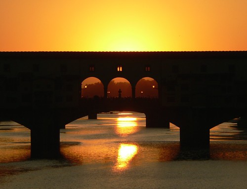
Ponte Vecchio Florence - Tuscany, Italy
The Ponte Vecchio ("Old Bridge", Italian pronunciation: [ˈponte ˈvɛkkjo]) is a Medieval bridge over the Arno River, in Florence, Italy, noted for still having shops built along it, as was once common.
Butchers initially occupied the shops; the present tenants are jewellers, art dealers and souvenir sellers. It has been described as Europe's oldest wholly-stone, closed-spandrel segmental arch bridge, but there are far older segmental arch bridges such as Alconétar Bridge.
The Ponte Vecchio's two neighbouring bridges are the Ponte Santa Trinità and the Ponte alle Grazie.
source and more info @: http://en.wikipedia.org/wiki/Ponte_Vecchio
Monday, August 2, 2010
Classiebawn Castle, Mullaghmore, Sligo, Ireland
Classiebawn Castle (Lord Mounbaten castle) which overlooks the charming resort of Mullaghmore, was built by Lord Mount Temple in 1874. The estate descended to the Mountbattens through the wife of the seventh Earl of Shaftesbury, a step-daughter of the Prime Minister Lord Viscount Palmerston, who resided in the castle and who also built Mullaghmore harbour back in the mid-nineteenth century.
The castle is now privately owned and not open to the public.
County Sligo (Irish: Contae Shligigh) is one of the twenty-six counties of the Republic of Ireland and one of the thirty-two counties of Ireland. It is located in the province of Connacht. It was named after the town of Sligo (Irish: Sligeach) which is the anglization of the Irish Sligeach meaning Place of the Shells. The population of the county is 60,894 according to the 2006 census.
Sligo is the 22nd largest of Ireland’s 32 counties in area and 25th largest in terms of population. It is the fourth largest of Connacht’s 5 counties in size and third largest in terms of population.
Sunday, August 1, 2010
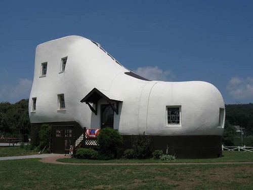
Haines Shoe House - near York, Pennsylvania USA
The Shoe House, built in 1948, was by far "Colonel" Mahlon N. Haines' most outlandish advertising gimmick. It is a wood frame structure covered with wire lath and coated with a cement stucco. It measures 48 ft. in length, 17 ft. in width at the widest part and 25 ft. in height. The interior consists of five different levels and contains three bedrooms, two baths, a kitchen and living room.
more: @ http://www.shoehouse.us/
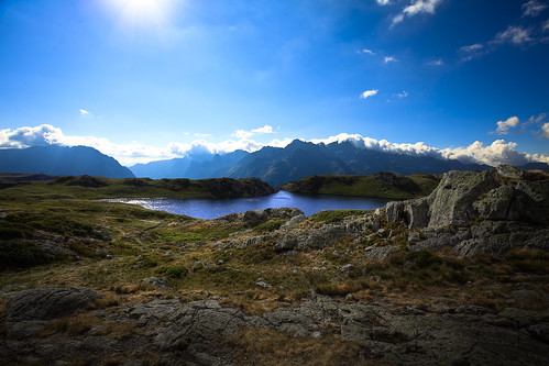
Savoy, Rono-Alpes, France
Savoie (Arpitan: Savouè d’Avâl, English: Savoy) is a French department located in the Rhône-Alpes (Rôno-Arpes) region in the French Alps.
It is one of the two departments of the region of Savoy that was annexed by France on March 24, 1860 after the Treaty of Turin, the other being Haute-Savoie. For history before 1860, details of the annexation and reasons for the current separatist movement in the departments, see Savoy.
source & info @: http://en.wikipedia.org/wiki/Savoie
la Boqueria, Barcelona Spain
The Mercat de Sant Josep de la Boqueria, often simply referred to as La Boqueria, is a large public market in the Ciutat Vella district of Barcelona, Catalonia, Spain and one of the city's foremost tourist landmarks, with an entrance from La Rambla, not far from the Liceu, Barcelona's opera house. The market has a very diverse selection of goods.
source & more info @: http://en.wikipedia.org/wiki/La_Boqueria
readers
labels and tags
- #travel (1)
- 2011 solstice (1)
- ABU DHABI (1)
- Acadia (1)
- Acropolis (1)
- ACTION DAY (3)
- ADRIATIC SEA (1)
- adventure (1)
- ADVENTURES (45)
- AEGEAN (21)
- Aegean Sea (2)
- AFRICA (11)
- AGRA (1)
- agriculture (1)
- AIRLINERS (7)
- airplane (2)
- airplane seating (2)
- AIRPORTS (2)
- AIX EN PROVENCE (1)
- ALASKA (3)
- ALHAMBRA (1)
- ALICANTE (1)
- ALSACE (2)
- AMALFI (2)
- amazing (2)
- AMAZONIA (1)
- AMERICAS (113)
- AMORGOS (1)
- AMSTERDAM (3)
- Anafi (1)
- ancient greece (1)
- Ancient Greek language (2)
- ANDALUCIA (2)
- ANDES (2)
- angle (1)
- Anglo-Canadian (1)
- ANTARCTICA (3)
- ANTWERP (2)
- archipeelago (1)
- ARCHITECTURE WONDERS (86)
- ARCTIC (8)
- arctic ice (2)
- arctic ocean (1)
- ARGENTINA (3)
- ARGOS (1)
- Ariadnae (1)
- ARIZONA (2)
- articles (2)
- Artisanal olive oils (1)
- ASIA (95)
- ASIA MINOR (2)
- asklepios (1)
- ASPEN (1)
- ASTANA (1)
- astronomy (1)
- astrophotography (3)
- Athenian Democracy (2)
- ATHENS (23)
- ATHOS (2)
- ATLANTIC OCEAN (3)
- atmosphere (5)
- ATTIKI (3)
- AUCKLAND (1)
- aurora borealis (3)
- AUSTRALIA (7)
- AUSTRIA (4)
- autumn (2)
- Autumnal (1)
- AVEIRO (1)
- awesome (2)
- BAJA (1)
- BALI (3)
- BALLOONING (5)
- BALTIC STATES (1)
- BAMBERG (3)
- BARBADOS (2)
- BARCELONA (4)
- BARI (1)
- BAVARIA (2)
- bay area (1)
- beach getaway (1)
- BEACONS (2)
- beautiful destination (2)
- BEIJING (9)
- BELGIUM (5)
- BELIZE (1)
- BERLIN (2)
- BERNE (1)
- BHUTAN (1)
- BIG CITIES (16)
- BIRMINGHAM (1)
- BLED (1)
- blog (1)
- bloggers (1)
- BONIFACIO (2)
- BORA BORA (1)
- BORNEO (2)
- BOSTON (2)
- BOTANICAL (1)
- Bourbon str (1)
- BRAN (1)
- BRASOV (2)
- BRAZIL (2)
- BRETAGNE (2)
- BRIDGE (7)
- BRIGHTON (2)
- British (2)
- BRITISH COLUMBIA (1)
- BRITTANY (1)
- Bruges (1)
- BUCHAREST (1)
- BUDAPEST (2)
- BUDGET TOUR (9)
- BUENOS AIRES (1)
- BULGARIA (2)
- CALDERA (2)
- calendar (1)
- CALGARY (1)
- CALIFORNIA (7)
- CAMBODIA (1)
- CANADA (9)
- CANARY ISLES (3)
- CANNES (3)
- CAPE TOWN (2)
- CAPRI (1)
- cardpostal (1)
- CARIBBEAN ISLANDS (10)
- CARNIVAL (3)
- CASABLANCA (1)
- CASTELIFOLLIT DE LA ROCA (1)
- CASTLES (37)
- CAVES (2)
- CELEBRATIONS (2)
- CHALKIDIKI (2)
- CHANIA (2)
- Charlottetown (1)
- CHICAGO (1)
- CHILE (6)
- CHINA (23)
- christmas (1)
- civilization (2)
- climate change (2)
- COBH (1)
- COCHIN (1)
- COFFEE (3)
- Colmar (1)
- COLONE (2)
- COLORADO (2)
- comparison (1)
- CONEY ISLAND (1)
- Constanta (1)
- Constantinopole (1)
- COPENHAGEN (2)
- Corfu (1)
- CORNWAL (1)
- Cornwall (1)
- CORSICA (3)
- cosmos (2)
- COSTA DEL SOL (2)
- COTE D'AZUR (4)
- CRETE (7)
- CROATIA (1)
- CRUISE (12)
- cruise NEWS and BLOGS... (2)
- CUBA (2)
- CUENCA (1)
- Culinary (1)
- CULTURAL TOURS (67)
- culture (5)
- culure (1)
- Cyclades (1)
- CYPRUS (3)
- CZECH REPUBLIC (7)
- DAMASCUS (1)
- DANGEROUS PLACES (2)
- DARVAZ (1)
- DARWIN (4)
- december (1)
- declination (1)
- Delos (1)
- DELPHI (1)
- Democracy (1)
- demographic (1)
- DENALI(McKinley) (1)
- DENMARK (6)
- DESERT (7)
- design (1)
- DISNEYLAND Paris (1)
- DIVING (7)
- DOLOMITE (3)
- DOMINICAN REPUBLIC (1)
- DORDOGNE (1)
- DORSET (1)
- duba (1)
- DUBAI (8)
- DUBLIN (4)
- DUDLEY (1)
- DUSSELDORF (2)
- earth (2)
- earth hour (1)
- earth hour 2011 (1)
- Easter island (1)
- ECOTOUR (12)
- ECUADOR (1)
- EDINBURGH (1)
- EGESOV (1)
- ENDANGERED DESTINATIONS (1)
- environment (6)
- environmental (5)
- Epidaurus (1)
- EQUESTRIAN EVENT (1)
- ESA (1)
- estate (1)
- ESTONIA (1)
- ESTUARY (1)
- ETHIOPIA (1)
- ETNA (1)
- EUROPE (314)
- extra planetary TRAVEL (9)
- EZE (1)
- F1 TRAVELS (1)
- fairytale places (1)
- fall (1)
- famous (1)
- fantasy-like destination (1)
- FAR EAST (6)
- FERES (1)
- festival (1)
- FESTIVALS (10)
- FEZ (1)
- FINLAND (1)
- Flanders (1)
- FLORIDA (5)
- focus (1)
- foilage (1)
- FOLEGANDROS (2)
- FOLK ART (21)
- FOOD (21)
- FRANCE (38)
- FRANCONIA (2)
- FRANKFURT (2)
- French (3)
- FRENCH POLYNESIA (1)
- French Quarter (2)
- frequent fliers (1)
- FRISIA (1)
- GALWAY (1)
- Gardena Pass (1)
- GARDENS (1)
- GAVDOS (2)
- GENEVA (3)
- geography (1)
- GERMANY (27)
- GEYSIR (1)
- GLASGOW (1)
- Gloucester (1)
- google (1)
- Google Earth (1)
- gourmet (1)
- GRANADA (1)
- GRAND CANYON (1)
- GREECE (89)
- Greek art (1)
- GREEK ISLANDS (29)
- GREEK MAINLAND (6)
- GREENLAND (2)
- greetings (1)
- GREETSIEL (1)
- Grimaud (1)
- groves (1)
- Guangzhou (1)
- GUERNSEY (1)
- Halloween (1)
- HARLEM (1)
- HAWAII (3)
- hellas (1)
- Hellenistic art (2)
- HELMOS (1)
- HEREFORDSHIRE (1)
- heritage (1)
- HIGHLANDS (1)
- HIMALAYAS (2)
- HISTORIC TOUR (52)
- holidays (1)
- HONEYMOON (1)
- HONG KONG (4)
- HOTELS (24)
- HOUSTON (1)
- HUAN HI (1)
- HUNGARY (2)
- HYDRA (1)
- IBIZA (2)
- ICELAND (11)
- icescape (1)
- ILLINOIS (1)
- impresionist (1)
- INDIA (10)
- INDIAN OCEAN (4)
- INDONESIA (1)
- info-map (4)
- infographic (5)
- infographics (5)
- Infographics Artist (5)
- INNOVATIVE IDEAS (8)
- INNSBURG (1)
- IOANNINA (1)
- Ios (1)
- IRAN (2)
- ISLAS CALAPAGOS (1)
- ISLE OF EIGG (1)
- ISLE OF SKYE (1)
- islet (1)
- ISRAEL (1)
- ISTANBUL (2)
- ITALY (30)
- IZMIR (1)
- James Craig (1)
- JAPAN (9)
- jason de caires taylor (1)
- JERSEY (1)
- JOHANNESBURG (1)
- Juno (1)
- Jupiter (1)
- KARLOVY VARY (1)
- KARPATHOS (2)
- KAZAKHSTAN (1)
- KENT (1)
- KENTUCKY (1)
- KERALA (1)
- KIEV (1)
- Knossos (1)
- KOCHI (1)
- KOS (1)
- KOWLOON (1)
- KRUGER (1)
- KUWAIT (2)
- KYOTO (2)
- KYRGYZSTAN (1)
- LAHORE (1)
- LAKES (9)
- LAND TOUR (15)
- LandMark (42)
- LANGUAGE GUIDES (4)
- LANZAROTE (1)
- LAOS (1)
- LAS VEGAS (2)
- Latin (1)
- Latin language (1)
- LATVIA (1)
- LEEDS (1)
- LEICESTERSHIR (1)
- leisure (1)
- LICHTENSTEIN (2)
- LIFE TIME (64)
- lifetime (1)
- light (1)
- lighthouses (8)
- LIMASSOL (1)
- Lindos (1)
- LISBON (4)
- LITHUANIA (2)
- LIVERPOOL (1)
- LONDON (11)
- LOS ANGELES (1)
- LOUISIANA (1)
- Louvre (1)
- LUCERN (1)
- LUGANO (1)
- luxury resorts NEWS and BLOGS (8)
- MACEDONIA (1)
- Machu Picchu (1)
- MADEIRA ISLANDS (1)
- MADRID (1)
- magical places (1)
- MAGNA GRECIA (1)
- magnetic field (1)
- Maine (1)
- MALAGA (3)
- MALAYSIA (1)
- MALLORCA (2)
- MALTA (3)
- MANCHESTER (2)
- MANILA (1)
- MAPS (3)
- marina (1)
- Maritime (1)
- MARLOW (1)
- MARSEILLE (1)
- MARYLAND (1)
- MASSACHUSETTS (3)
- MED-diet (1)
- medieval festivals (1)
- Mediterranean (1)
- messinia (1)
- METEORA (2)
- MEXICO (4)
- MICHIGAN (1)
- MICRONATIONS (3)
- MID.EAST (11)
- MILAN (1)
- milky way (1)
- Milos (1)
- Moai (1)
- MONACO (3)
- monastery (1)
- Monet (1)
- MONGOLIA (3)
- MONTANA (1)
- MONUMENTS (4)
- MORROCO (1)
- MOSCOW (5)
- MOUNTAINS (13)
- MOVIES (3)
- MUNICH (6)
- museum (2)
- MUSEUMS (28)
- MYANMAR (1)
- Mycenae (1)
- MYCONOS (2)
- N. IRELAND (1)
- N.AMERICA (76)
- N.Carolina (1)
- Nagorno-karabakh (1)
- NAPLES (1)
- nasa (2)
- NASA Goddard (1)
- National Memorials (1)
- NATURAL WONDERS. (33)
- nature (2)
- NEPAL (2)
- neuchatel (1)
- NEVADA (2)
- NEW HAMPSHIRE (1)
- NEW MEXICO (2)
- NEW ORLEANS (1)
- new south wales (1)
- NEW YORK (20)
- NEW ZEALAND (1)
- NICE (3)
- NIGHT LIFE (6)
- NORMANDY (3)
- North Carolina (1)
- NORTH SEA (3)
- NORTH YORKSHIRE (1)
- NORTHEN TERRITORIES (2)
- northern lights (3)
- NORWAY (4)
- Nova Scotia (2)
- NUREMBERG (1)
- NYT travel (1)
- OAKLAND (1)
- OCEANIA (5)
- OLD TOWN (1)
- olives (1)
- Olympia (1)
- OLYMPIC VENUES (3)
- OMAN (2)
- one day on earth (1)
- OREGON (3)
- OTTAWA (1)
- oxford (1)
- PACIFIC ISLANDS (7)
- pacific ocean (2)
- paintings (1)
- PAKISTAN (2)
- PALMA de MALLORCA (2)
- PARGA (3)
- PARIS (15)
- PELOPONNESUS (5)
- PENA (1)
- PENNSYLVANIA (5)
- PERGAMOS.EPHESUS (1)
- PERU (3)
- Petit St. Vincent (1)
- phenomenon (2)
- PHI PHI (2)
- Philadelphia (1)
- PHILIPPINES (1)
- PHNOM PENH (1)
- photography (43)
- PHOTOS (377)
- PHUKET (1)
- pier (1)
- pigs (1)
- PIRAEUS (1)
- Pissaro (1)
- PITTSBURG (1)
- planet (1)
- PLOVDIV (1)
- poetry (1)
- POLAND (3)
- politcs (2)
- pontos (1)
- Portland (2)
- PORTUGAL (8)
- POTSDAM (1)
- PRAGUE (7)
- PRESENTATION (7)
- Private Islands (1)
- provinces (1)
- QUEBEC (2)
- RABAT (1)
- rainforest (1)
- RAINFOREST TRIBES (2)
- REPUBLIC of IRELAND (9)
- reutlingen (1)
- REYKJAVIK (2)
- RHEIN VALEY (1)
- RHODES (3)
- RIGA (1)
- RIVERS (5)
- ROMANIA (10)
- romantic destination (1)
- ROMANTIC TOUR (37)
- ROME (2)
- RONDA (1)
- Roseland peninsula (1)
- ruins (1)
- RUSSIA (5)
- S. America (2)
- S. KOREA (1)
- S.AFRICA (4)
- S.AMERICA (12)
- S.Dakota (1)
- S.LAWRENCE (1)
- SACRED PLACES (30)
- SAFARI's (1)
- sahara desert (2)
- Saint Paul de Vence (2)
- SALZBURG (2)
- SAMOS ISLAND (4)
- SAN ALFONSO DEL MAR (1)
- SAN FRANCISCO (3)
- SAN REMO (2)
- SAN TROPE (1)
- sanctuary (1)
- SANDANSKI (1)
- sandstorm (1)
- SANTORINI (9)
- SARLAT (1)
- saronic gulf (1)
- satellite (1)
- SAUDI ARABIA (1)
- SCHLESWIG-HOLSTEIN (1)
- SCOTLAND (15)
- SCUBA (1)
- sculpture (2)
- seacoast (3)
- SEASONAL (24)
- SEATTLE (2)
- SEX (2)
- SEYCHELLES (1)
- SHANGHAI (1)
- SHOWS (1)
- SIBIU (2)
- SICILY (1)
- SIERRA LA RANA (1)
- SIGHISOARA (1)
- SINGAPORE (2)
- SINTRA (1)
- SKI (6)
- SKOGAR (1)
- sky (2)
- skyline (1)
- SKYscraper (2)
- SLOVAKIA (1)
- SLOVENIA (2)
- social bookmarking (1)
- social media (1)
- Social networking (1)
- social travel (1)
- SOCOTRA (1)
- SOFIA (1)
- solstice (1)
- SOPA/PIPA (1)
- SOUNION (2)
- SPA (7)
- space (2)
- space age (2)
- space era (1)
- Space Shuttle (1)
- SPACE TRAVEL (18)
- spaceships (2)
- SPAIN (25)
- SPECIAL EVENT (39)
- SPORADES (2)
- ST. KILDA (1)
- ST.PETERSBURG (1)
- steppe (1)
- STOCKHOLM (3)
- Study (1)
- SUMATRA (1)
- summit (1)
- sun (3)
- sun activity (2)
- sunrise sunset (1)
- SWEDEN (4)
- SWITZERLAND (6)
- SYRIA (2)
- TALLINN (1)
- TED (1)
- TENNESSEE (1)
- Tenuta di Spannocchia (1)
- TEXAS (2)
- THAILAND (6)
- THAMES (1)
- the best of Mediterranean coast (1)
- THE NETHERLANDS (4)
- the silent evolution (1)
- THEME PARKS (6)
- THESSALONIKI (2)
- THESSALY (1)
- tilt-shift video (1)
- time lapse (4)
- TOKYO (1)
- tourism (3)
- tours (2)
- traditional music (20)
- TRAIN and LOCOMOTIVES (1)
- travel (14)
- TRAVEL ART (24)
- TRAVEL ARTICLE (3)
- TRAVEL BOOKS (4)
- Travel daily News (1)
- TRAVEL FUTURE (19)
- TRAVEL GEAR (8)
- TRAVEL HEALTH (4)
- TRAVEL HISTORY (21)
- TRAVEL HUMOR (14)
- TRAVEL POETRY (20)
- TRAVEL QUIZ (2)
- TRAVEL TIPS (41)
- Travel Utopia (53)
- travelling around (10)
- travelling around... (285)
- tribute (1)
- Trip Advisor (1)
- Tripl (1)
- TROPICAL (11)
- TROPICAL PARADISE (13)
- TToT (1)
- TURKEY (3)
- TUSCANY (3)
- U.A.E. (10)
- UK (45)
- UKRAINE (2)
- underwater (1)
- UNESCO heritage (1)
- univrse (1)
- unreal (2)
- upholstery (1)
- urban destination (9)
- URBAN DESTINATIONS (89)
- urbanism (3)
- urine (1)
- USA (76)
- utah (1)
- UZBEKISTAN (1)
- vacances (1)
- VACATIONS (17)
- VADUZ (1)
- VALENCIA (2)
- VALPARAISO (1)
- VANCOUVER (1)
- VANUATU (2)
- VATICAN STATE (1)
- Veni (1)
- VENICE (9)
- Venus de Milo (1)
- Verba Verti (1)
- Vergina (1)
- VERMONT (1)
- VICTORIA FALLS (2)
- VICTORIA HARBOUR (1)
- video (24)
- VIDEOS (79)
- Vidi (1)
- VIENNA (3)
- Villefranche-sur-Mer (1)
- VILNIUS (2)
- VINTAGE TRAVEL POSTERS (6)
- VIRGINIA (1)
- virtual tours (14)
- visit Greece (1)
- VOLCANO (3)
- WALES (1)
- WALKING TOURS (48)
- WASHINGTON_DC (2)
- WEIRDnews (11)
- WEIRDPLACES (63)
- wild places (2)
- XANTHI (1)
- yellow (1)
- YEMEN (1)
- ZANTE (1)
- ZARAGOZA (1)
- zero gravity (1)
- ZIMBABWE (1)
- zoo (1)
- ZURICH (2)
- ΑQUARIUM (2)
- Αγωνιστικη Λεσχη Καρπενησιου (1)
- Αθηνα (1)
- αμφιδρομη επικοινωνια (1)
- ασφαλτινο ραλλυ (1)
- αυξηση θερμοκρασιας (1)
- Δ. Κ. Γεωργαλας (1)
- διαδυκτιο (1)
- δικτυωση (1)
- εθνικος οργανισμος Τουρισμου (1)
- εκδηλωση (1)
- εκθεσεις (1)
- ελευθερια (1)
- Ελευθεροτυπια (1)
- Ελλαδα (4)
- επετειακο (1)
- Ευρυτανια (1)
- Ευρωπη (1)
- θαλασσα (1)
- ιστορια (1)
- Κ. Μπακογιάννης (2)
- Καρπενησι (2)
- Κερκυρα (1)
- κλιμα (1)
- κλιματικη αλλαγη (1)
- κοινωνικά δίκτυα (1)
- Κρητη (2)
- λιστα (1)
- νεοι ανθρωποι (1)
- νεος Δημος Καρπενησιου (2)
- παραθαλασσιοι (1)
- περιβαλλον (1)
- πολιτικη ιστορια (1)
- προορισμοι (1)
- ραλλυ σπριντ (1)
- Ροδος (1)
- Σαντορινη (1)
- τουρισμος (4)
- φιλελευθερισμος (1)
- φωτογραφια (1)
- Χριστουγεννα (1)
- ωρα (1)
- ωρα της ΓΗς (1)











In recent decades, Phipps has evolved into one of the region's most vibrant, thriving cultural attractions, bringing fresh perspectives and artists into our historic glasshouse environment. Phipps has also become a strong advocate for advanced green-building practices, sustainable gardening and a new environmental awareness.
more @: http://phipps.conservatory.org/